
Cities around the world are undergoing a profound transformation. Rapid urbanization, aging infrastructure, growing vehicle populations, and tightening municipal budgets are pushing city planners to rethink how road networks are managed. Roads are among the most visible and heavily used public assets, yet in most cities, they are still maintained using outdated, reactive methods—fixed only after complaints pile up or damage becomes severe.
Road asset management has emerged as a critical discipline to address these challenges. By combining Geographic Information Systems (GIS), Internet of Things (IoT) sensors, and artificial intelligence, cities across the globe are shifting from reactive, complaint-driven road maintenance to data-driven, predictive infrastructure planning. In this blog, we'll explore what road asset management means in the smart city context, the technologies powering it, real-world implementations, and the challenges that lie ahead.
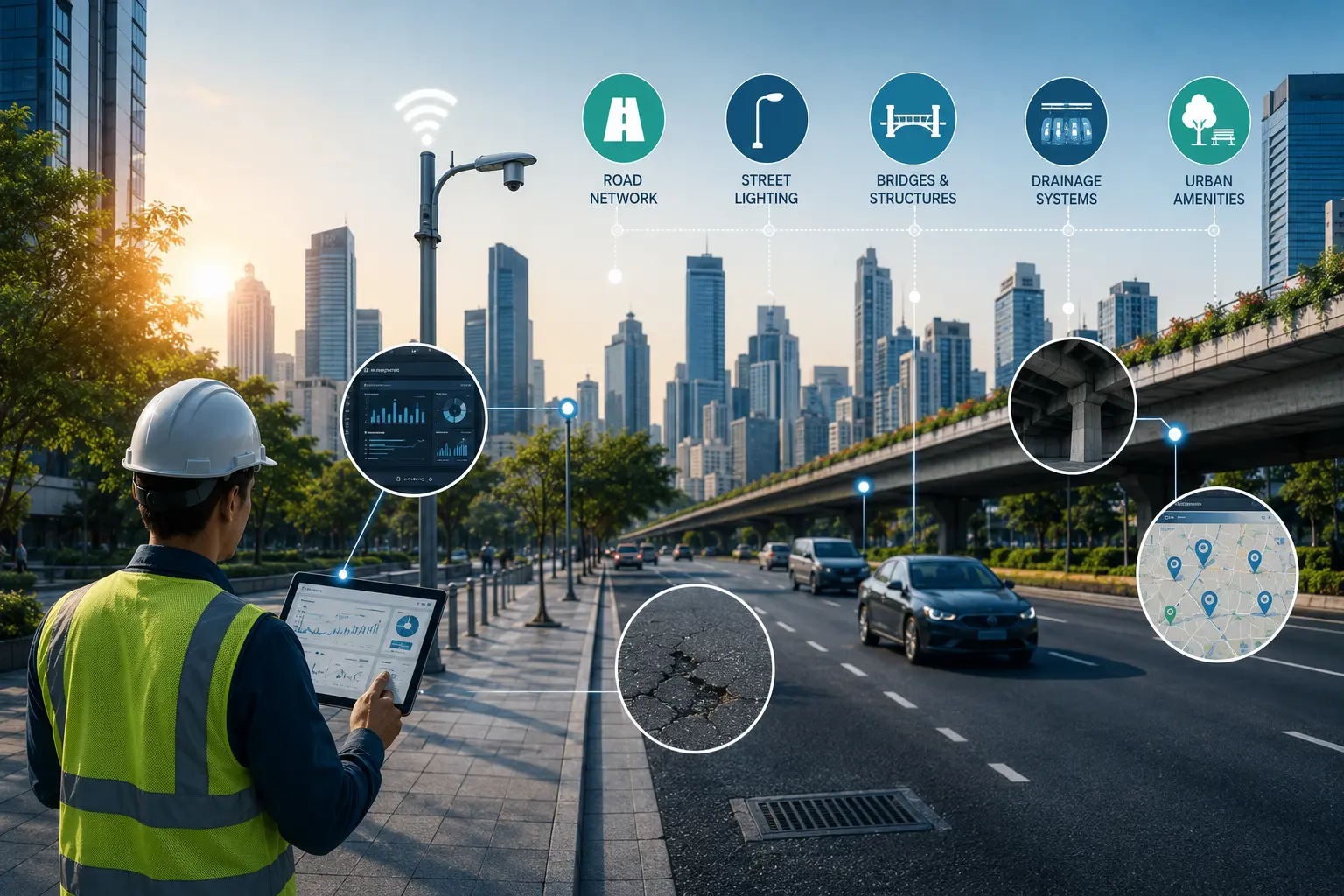
Road asset management refers to the systematic process of planning, monitoring, maintaining, and upgrading road infrastructure over its entire lifecycle. It involves tracking not just the road surface itself, but related assets such as:
In the context of smart cities, road asset management goes beyond simple record-keeping. It integrates real-time data collection, predictive analytics, and centralized digital dashboards to give city planners a comprehensive, continuously updated view of road infrastructure health across an entire municipality.
Urban road networks worldwide face similar structural challenges, regardless of geography. Many cities operate with fragmented governance—municipal departments, utility companies, and regional transportation authorities often work with limited coordination. This fragmentation creates several recurring problems:
Smart, technology-driven road asset management directly addresses these issues by creating a single source of truth for road infrastructure data.
Geographic Information Systems form the foundation of modern road asset management. Every road segment, along with its associated assets (lights, signals, drains), is mapped digitally with precise geospatial coordinates. This allows city officials to visualize infrastructure across the entire municipality on a single interactive map, rather than relying on fragmented paper records.
Artificial intelligence enables automated detection of road defects—potholes, cracks, rutting, and surface roughness—using cameras and sensors mounted on municipal vehicles, buses, or ride-share fleets. Computer vision models analyze this data to classify defect severity and prioritize repairs, similar to how AI-powered pothole detection systems work at scale.
Internet of Things sensors embedded in road infrastructure—or mounted on vehicles—continuously collect data on traffic load, vibration, temperature, and moisture levels. This data helps predict when a road segment is likely to deteriorate, enabling preventive maintenance before major damage occurs.
By analyzing historical maintenance records, traffic patterns, and weather data, AI models can forecast which road segments are at highest risk of failure. Some advanced smart city projects are even experimenting with digital twins—virtual replicas of road networks that simulate wear patterns and test maintenance strategies before real-world implementation.
Modern road asset management platforms consolidate data from multiple sources into a single dashboard accessible to municipal engineers, contractors, and city officials. These dashboards typically include heat maps of problem areas, maintenance schedules, budget tracking, and citizen complaint integration.
Many cities have introduced mobile apps and online portals that allow residents to report potholes, broken streetlights, or drainage issues directly. AI-powered validation ensures these reports are accurately categorized and routed to the appropriate department, closing the loop between citizens and city planners.
Smart city initiatives around the world have become major catalysts for adopting technology-driven road asset management. Common patterns of progress include:
While adoption varies significantly across regions and budgets, these initiatives represent a broader global shift toward data-driven, accountable infrastructure management.
Despite promising pilot projects, scaling road asset management technology across diverse urban landscapes faces several common hurdles:
As cities continue to grow and modernize, several trends are likely to shape the future of road asset management globally:
Road asset management is becoming a cornerstone of smart city development worldwide, offering a path away from fragmented, reactive road maintenance toward a data-driven, accountable, and preventive approach. By leveraging GIS mapping, AI-powered condition monitoring, IoT sensors, and citizen engagement platforms, cities across the globe have an opportunity to significantly improve road safety, reduce long-term maintenance costs, and build more resilient urban infrastructure. While challenges around governance fragmentation, funding, and standardization remain, the growing momentum behind smart city initiatives suggests that intelligent road asset management will play an increasingly central role in shaping the future of urban mobility everywhere.
Road asset management is the systematic process of planning, monitoring, and maintaining road infrastructure—including road surfaces, lighting, signage, and drainage—using digital tools like GIS, IoT sensors, and AI to improve efficiency and decision-making.
Smart city initiatives encourage cities to adopt technology-driven infrastructure management, including centralized command centers, GIS-based asset registers, and AI-powered road monitoring, as part of broader digital transformation goals.
Common technologies include GIS mapping, AI-based computer vision for defect detection, IoT sensors for real-time monitoring, predictive analytics, and centralized digital dashboards for municipal planning.
Yes, many cities have introduced mobile apps and portals that allow residents to report potholes, drainage issues, or damaged infrastructure, which are then validated and prioritized using AI and routed to the relevant department.
No. While large metros have led early adoption, decreasing technology costs are making road asset management increasingly viable for mid-sized and smaller cities, where infrastructure challenges are often just as significant.

The Autonomous Road Engineer
AI-powered road condition monitoring, asset management, & infrastructure intelligence helping agencies move from reactive maintenance to predictive road management.


.webp)
.webp)
.webp)