Smart City Road Monitoring Solutions: AI-Powered Infrastructure Tech
On this page
As cities worldwide race to modernize their infrastructure, roads remain one of the most critical yet under-monitored public assets. Traditional methods of tracking road conditions manual inspections, citizen complaints, and periodic surveys simply cannot keep pace with the scale and speed of urban growth. Roads deteriorate continuously due to traffic load, weather, and material aging, and without timely intervention, minor cracks and potholes evolve into costly, dangerous problems.
Smart city road monitoring solutions are changing this dynamic. By combining artificial intelligence, IoT sensors, GIS mapping, and real-time data analytics, these systems give city planners continuous visibility into road conditions across entire urban networks. In this blog, we'll explore what smart city road monitoring solutions are, how they work, the technologies behind them, and how they're reshaping urban infrastructure management around the world.
What Are Smart City Road Monitoring Solutions?
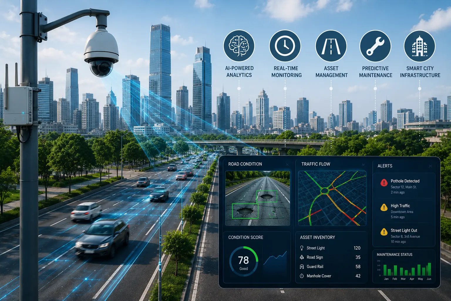
Smart city road monitoring solutions are integrated technology platforms designed to continuously track, analyze, and report on the condition of road infrastructure within an urban environment. Rather than relying on periodic manual inspections, these solutions use a combination of hardware and software to automate data collection and analysis, including:
Vehicle-mounted or drone-based cameras for visual inspection
Accelerometers and vibration sensors to detect surface irregularities
GPS modules for precise geolocation of defects
AI-based computer vision models to identify and classify road issues
Cloud dashboards for centralized monitoring and reporting
These solutions are typically deployed as part of a broader smart city ecosystem, integrating with traffic management systems, public works departments, and citizen engagement platforms to create a unified view of urban road health.
Why Cities Need Smart Road Monitoring Solutions
Urban road networks face a growing set of pressures that traditional monitoring methods struggle to address:
Scale of Modern Cities: Large metropolitan areas can span thousands of kilometers of roadway, making manual inspection slow, expensive, and incomplete.
Rising Traffic Loads: Increasing vehicle ownership and commercial transport accelerate road wear, requiring more frequent and precise monitoring.
Climate and Weather Stress: Flooding, freeze-thaw cycles, and extreme heat all contribute to faster road deterioration, often in unpredictable patterns.
Budget Pressures: Municipal governments must justify infrastructure spending with data, making evidence-based prioritization essential.
Public Safety Expectations: Citizens increasingly expect fast, responsive government services, including timely road repairs and hazard alerts.
Fragmented Legacy Systems: Many cities still manage road data through disconnected spreadsheets or paper records, making it difficult to track trends or plan proactively.
Smart road monitoring solutions address these pressures by replacing slow, manual processes with continuous, automated, and data-driven infrastructure management.
Core Components of Smart City Road Monitoring Solutions
1. Data Collection Layer
The foundation of any road monitoring solution is data capture. This typically involves:
Fleet-mounted cameras installed on municipal vehicles, buses, or waste collection trucks that passively capture road footage during regular routes
Dedicated inspection vehicles equipped with high-resolution cameras, LiDAR, and vibration sensors for detailed surveys
Drones for aerial inspection of highways, bridges, and hard-to-reach infrastructure
Crowdsourced smartphone data from citizen reporting apps or ride-share and delivery fleets
2. AI and Computer Vision Analysis
Once data is captured, AI models typically built on convolutional neural networks and object detection frameworks analyze images and video to identify potholes, cracks, rutting, and other surface defects. These models are trained on large datasets covering diverse lighting, weather, and road surface conditions to maintain high detection accuracy.
3. Sensor Fusion
Many advanced systems combine visual data with accelerometer and gyroscope readings. When a vehicle's suspension reacts to a rough patch or dip, this vibration data is cross-referenced with visual detection to reduce false positives and improve overall reliability.
4. Severity Classification and Prioritization
Not every road defect requires the same urgency. AI-powered platforms classify detected issues by severity minor, moderate, or critical based on size, depth, and location context, such as proximity to schools, hospitals, or high-traffic corridors. This enables maintenance teams to prioritize the most dangerous or high-impact issues first.
5. GIS Integration and Mapping
Every detected defect is geotagged and layered onto a GIS-based map, allowing city officials to visualize road conditions across their entire jurisdiction. This spatial view makes it easy to identify problem clusters, plan maintenance routes efficiently, and track condition trends over time.
6. Centralized Dashboards and Reporting
Smart road monitoring platforms typically include web-based dashboards that consolidate data for city engineers, contractors, and administrators. These dashboards often feature heat maps, maintenance scheduling tools, budget tracking, and automated report generation for regulatory or public transparency purposes.
7. Automated Alerts and Work Order Integration
In more advanced deployments, detected issues automatically trigger work orders in municipal maintenance management systems, eliminating manual data entry and reducing the time between detection and repair.
Key Benefits of Smart City Road Monitoring Solutions
For City Governments and Public Works Departments
Continuous Visibility: Real-time monitoring replaces infrequent manual surveys, ensuring road conditions are always up to date.
Cost Savings: Early detection and preventive maintenance are significantly cheaper than reactive repairs or full-scale reconstruction.
Improved Interdepartmental Coordination: Centralized platforms reduce duplicated work between road authorities, utility companies, and maintenance contractors.
For Residents and Road Users
Safer Streets: Faster detection and repair of hazards reduces accident risk and vehicle damage.
Better Communication: Citizen-facing apps and portals improve transparency around reported issues and repair timelines.
Smoother Commutes: Well-maintained roads reduce wear on vehicles and improve overall travel comfort.
For Maintenance Contractors and Private Partners
Optimized Resource Deployment: Precise defect location data allows crews to plan efficient repair routes.
Performance-Based Contracts: Objective monitoring data supports contracts tied to measurable outcomes rather than fixed schedules.
Reduced Disputes: Transparent, sensor-based data minimizes disagreements over repair quality or completion.
Real-World Applications of Smart Road Monitoring Solutions
Municipal Fleet Integration: Cities are increasingly equipping garbage trucks, buses, and utility vehicles with dashcams to passively collect road condition data during normal operations, avoiding the cost of dedicated inspection fleets.
Highway and Expressway Monitoring: Regional transportation authorities use AI-equipped vehicles to survey extensive highway networks far faster than traditional manual crews.
Bridge and Structural Monitoring: Drone-based inspections combined with AI analysis help identify structural risks in bridges, overpasses, and elevated roadways.
Traffic Management Integration: Some smart city platforms combine road condition data with traffic flow analytics, allowing cities to understand how infrastructure quality impacts congestion and travel times.
Emergency Response Coordination: Real-time road condition data helps emergency services identify safe, passable routes during severe weather events or natural disasters.
Choosing the Right Smart Road Monitoring Solution
Cities evaluating road monitoring platforms should consider several key factors:
Detection Accuracy: Look for solutions with proven performance across varied lighting, weather, and road surface conditions.
Scalability: The platform should be able to expand from pilot programs to citywide or regional deployment without major infrastructure changes.
Integration Capabilities: Compatibility with existing GIS systems, maintenance management software, and citizen engagement platforms is essential for seamless adoption.
Data Ownership and Privacy: Cities should ensure clear policies around data storage, privacy, and usage, particularly for video and location data.
Total Cost of Ownership: Beyond initial hardware costs, consider ongoing subscription fees, maintenance, and support requirements.
Vendor Track Record: Evaluate case studies and references from other municipalities of similar size and infrastructure complexity.
Challenges in Deploying Smart Road Monitoring Solutions
While the benefits are substantial, cities may encounter several implementation challenges:
Upfront Investment: Hardware, software licensing, and integration work require meaningful initial capital, which can be a barrier for smaller municipalities.
Legacy System Integration: Connecting new monitoring platforms with older asset management or work order systems can require custom development.
Data Privacy and Governance: Continuous video and location data collection raises privacy considerations that must be carefully managed.
Environmental Variability: AI models must be trained and validated across diverse weather and lighting conditions to maintain consistent accuracy.
Change Management: Shifting from manual, reactive workflows to automated, data-driven processes requires staff training and organizational buy-in.
The Future of Smart City Road Monitoring
As sensor costs decline and AI models continue to improve, smart road monitoring solutions are expected to become standard infrastructure for cities of all sizes. Emerging trends include:
5G-Enabled Real-Time Monitoring: Faster connectivity will enable near-instantaneous defect detection and reporting, shrinking the gap between identification and repair.
Autonomous Vehicle Integration: Self-driving vehicles will both benefit from and contribute to road condition data, creating continuous feedback loops for infrastructure improvement.
Digital Twin Development: Cities are increasingly building digital replicas of their road networks to simulate maintenance strategies and predict long-term infrastructure needs.
Cross-City Data Sharing: Regional and national platforms may emerge to aggregate road condition data across multiple municipalities, supporting broader infrastructure planning and funding decisions.
Satellite and Aerial Monitoring: High-resolution satellite imagery combined with AI could extend monitoring capabilities to remote or hard-to-access road networks without ground-based inspection.
Conclusion
Smart city road monitoring solutions represent a fundamental shift in how urban infrastructure is managed from reactive, manual inspection to continuous, AI-powered, data-driven oversight. By integrating computer vision, IoT sensors, GIS mapping, and centralized analytics, these platforms help cities detect problems earlier, allocate maintenance budgets more effectively, and ultimately build safer, more resilient road networks. As smart city initiatives continue to expand globally, road monitoring technology will remain a foundational pillar of modern urban infrastructure management.
Ready to see RoadVision AI in action? Contact our team today to schedule a live demonstration or discuss your smart city road monitoring requirements.
Frequently Asked Questions (FAQs)
1. What are smart city road monitoring solutions?
Smart city road monitoring solutions are technology platforms that use AI, IoT sensors, cameras, and GIS mapping to continuously track and analyze road conditions, automatically detecting defects like potholes and cracks in real time.
2. How do smart road monitoring systems detect road defects?
These systems typically use computer vision models to analyze images and video captured by vehicle-mounted cameras, combined with accelerometer and vibration sensor data, to identify and classify road surface issues.
3. What are the benefits of smart city road monitoring for municipalities?
Benefits include continuous visibility into road conditions, reduced maintenance costs through preventive repairs, data-driven budget allocation, and improved coordination between city departments and contractors.
4. Can smart road monitoring solutions integrate with existing city systems?
Yes, most modern platforms are designed to integrate with GIS systems, municipal asset management software, and citizen engagement apps, though the level of integration can vary by vendor and city infrastructure.




.webp)
.webp)
.webp)