
Road maintenance contractors, public works agencies, highway authorities, and infrastructure concessionaires operating large field workforces and mixed vehicle fleets rely on Trimble’s field and fleet operations technology stack spanning Trimble PULSE Telematics, Trimble Field Service Management (FSM), Trimble Viewpoint for construction and infrastructure project management, and the broader Trimble Connected Worker ecosystem to coordinate the people, vehicles, and equipment that maintain road infrastructure at operational scale. Trimble’s stack is the connective tissue between where crews are, what vehicles are doing, what tasks are assigned, and what the operational record shows was completed. For organisations where field execution efficiency and fleet asset utilisation determine the economics of road maintenance, the Trimble environment is not going anywhere.
But one question is coming up consistently across road maintenance contractors and public works operations teams running Trimble: how do we turn the vehicle fleet we already operate trucks that drive every lane mile of the network every week into a continuous road condition intelligence system, feeding current condition data back into the Trimble field management environment that our crews and planners already work in?
This guide is written specifically for operations managers, fleet managers, road maintenance contractors, and Trimble system administrators who are already working within the Trimble field and fleet operations ecosystem and are evaluating how AI-powered road condition assessment integrates into not alongside the connected field and fleet platform their teams use daily.
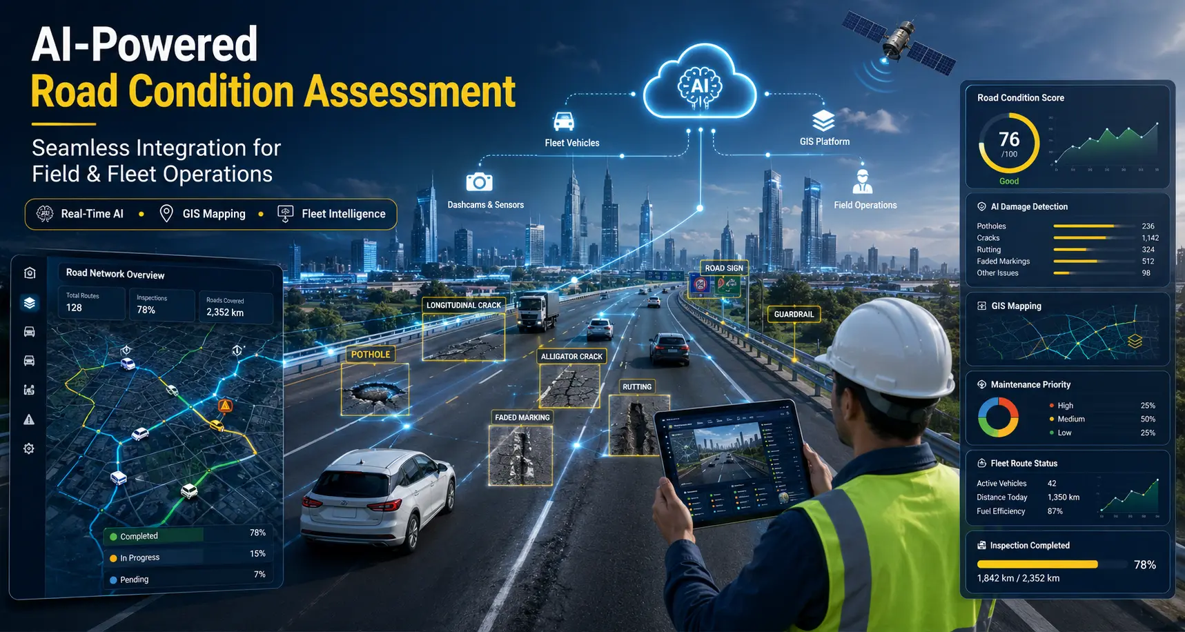
Before covering where AI fits, it is worth being precise about what Trimble’s field and fleet stack actually provides for road maintenance operations because this determines exactly where an AI road condition intelligence layer connects and how it strengthens field execution.
Trimble’s field and fleet operations platform is not a single product but a connected technology ecosystem spanning telematics, field service management, connected worker tools, and construction and infrastructure project management linked by Trimble’s cloud platform and data integration layer. For road maintenance organisations, these components combine into an integrated operational environment that tracks where every vehicle is, what every crew member is doing, what work has been assigned and completed, and what the cost and productivity record of the operation shows.
Trimble PULSE provides GPS-based vehicle tracking, engine diagnostics, driver behaviour monitoring, fuel consumption reporting, and fleet utilisation analytics across road maintenance vehicle fleets. For organisations operating mixed fleets of graders, trucks, rollers, sweepers, and patrol vehicles across large road networks, PULSE provides real-time fleet visibility: where every vehicle is, what it is doing, how it is being driven, and whether its maintenance schedule is current. This real-time fleet location data is directly relevant to AI road survey integration because every PULSE-tracked vehicle driving the road network is already a potential survey platform. The GPS journey record that PULSE already maintains for every vehicle is the spatial foundation onto which AI-detected road condition data maps.
Trimble Field Service Management provides work order management, technician scheduling and dispatch, mobile task completion, and field crew communication for infrastructure maintenance operations. For road maintenance, FSM connects work orders from the back-office planning system to the field crew’s mobile device providing the task details, location, materials, and completion recording tools that crew members need to execute and document maintenance activities in the field. FSM’s dispatch engine is the operational endpoint where road condition intelligence needs to arrive: as an actionable task assigned to the right crew, at the right location, with the right priority and photographic evidence of what needs to be done.
Trimble Viewpoint provides project management, document control, cost management, subcontractor management, and field data collection for construction and infrastructure projects. For road maintenance contractors managing a portfolio of maintenance contracts alongside capital improvement projects, Viewpoint provides the project financial management layer tracking contract revenue, project costs, subcontractor billing, and compliance documentation across the full programme. AI-generated road condition data connects to Viewpoint as the evidence basis for maintenance programme deliverables, contract performance documentation, and capital project identification triggered by AI-detected deterioration beyond routine maintenance thresholds.
Trimble’s Connected Worker platform provides mobile tools for field crew task management, digital forms, safety checklists, incident reporting, and real-time communication between field staff and back-office operations. For road maintenance crews, Connected Worker is the digital layer between the work order in the system and the maintenance activity in the field replacing paper job cards and manual inspection forms with structured digital records that feed back into the operational system in real time. AI road condition findings delivered as pre-populated digital task records in Connected Worker eliminate the manual field assessment step: crew members arrive at the defect location briefed with what to fix, where it is, and what it looks like, derived directly from the AI survey.
Trimble acquired Cityworks in 2020, making Cityworks AMS a native component of the Trimble infrastructure technology ecosystem. For road agencies and contractors using both Cityworks AMS and Trimble field and fleet tools, the integration between the two platforms is a pre-built, supported connection rather than a custom development. Work orders flow from Cityworks AMS into Trimble FSM for field execution; field completion data flows back from Trimble mobile tools into Cityworks. AI road condition data delivered into this environment feeds both systems simultaneously: Cityworks AMS receives the asset condition record and work order trigger; Trimble FSM receives the dispatched task for crew execution.
Across its field, fleet, and project management products, Trimble aggregates operational data into a cloud-based analytics and reporting environment that provides operations managers with productivity dashboards, contract performance metrics, fleet utilisation reports, and maintenance programme KPIs. For road maintenance organisations, this analytics layer is where field execution data tasks completed, distances covered, crews deployed, costs incurred is translated into the performance reporting that operations directors, finance teams, and client agencies review. AI road condition intelligence integrated into this environment adds the network condition dimension that field execution data alone cannot provide.
Trimble’s field and fleet platform provides exceptional visibility into what road maintenance crews and vehicles are doing, where they are, and what tasks they have completed. What it does not provide because it is an operations execution platform rather than a condition assessment system is systematic, current intelligence about the physical state of the road network that those crews are maintaining.
This gap matters for road maintenance organisations in ways that affect both operational efficiency and commercial outcomes:
The result: a connected field and fleet platform with excellent operational execution capability, tracking every vehicle journey across the road network, but generating no structured intelligence about the condition of the network surface that the fleet is responsible for maintaining.
This is not a gap in Trimble’s design intent. Trimble’s stack is built to execute and manage maintenance operations efficiently. What it is designed to receive and act on not generate is the road condition intelligence that determines what operations are needed. AI road surveys provide exactly that intelligence, in a form the Trimble environment is built to consume.
AI-based computer vision for road surveys addresses the condition intelligence gap directly and does so in a way that is operationally native to the Trimble field and fleet environment. The approach is straightforward: a vehicle-mounted dashcam captures geo-tagged, time-stamped video of the road network as the vehicle drives at normal operating speeds. That footage is processed through AI models that detect and classify road conditions and assets automatically, returning structured, geo-referenced condition intelligence that feeds into Trimble’s field dispatch, fleet management, and project management tools as actionable operational data.
The critical operational point for Trimble-based organisations: the survey platform is the existing Trimble-tracked fleet. Patrol trucks, maintenance vehicles, and inspection vans that Trimble PULSE already tracks as they drive the road network become simultaneous condition survey platforms when fitted with a dashcam. Every PULSE-recorded vehicle journey generates a concurrent road condition dataset. The fleet that Trimble already knows is on the road starts returning condition intelligence alongside the operational data it already provides with no additional crew time, no route deviation, and no operational change beyond mounting a camera.
RoadVision AI’s models are trained on over 100 million road images from networks across South Asia, the Middle East, Southeast Asia, Europe, and Africa covering the diverse pavement types, climate conditions, and road classifications that road maintenance contractors and highway authorities manage across Trimble’s global customer base. The training breadth ensures that AI condition scores are consistent and accurate across the full range of network types a Trimble-using organisation might maintain: motorway carriageways, rural regional roads, tropical Asian highways, and freeze-thaw-affected North American local roads.
A single dashcam survey pass, processed through the RoadVision AI pipeline, returns structured condition intelligence across the following categories each structured to feed the relevant Trimble operational tool:
Detection and classification of surface distress including potholes, longitudinal cracking, transverse cracking, alligator (fatigue) cracking, rutting, edge deterioration, patching quality, and surface ravelling. Each finding is severity-scored (Low / Medium / High / Critical) and contributes to a per-segment Pavement Condition Index (PCI) aligned to ASTM D6433 and IRC:116. An IRI-equivalent roughness value is also returned per 100-metre segment. Severity-scored defect detections map directly to Trimble FSM work order creation and Connected Worker task assignment, with defect location, type, and priority pre-populated in the field task record from the AI survey output.
Automated detection and classification of 80+ road asset types: regulatory signage, warning signs, informational signs, road markings (centreline, edge line, stop bars, pedestrian crossings, chevrons), kerb and edge conditions, guard rails and safety barriers, crash attenuators, drainage structures, culverts, lighting columns, overhead gantries, variable message signs, and ITS infrastructure. Every detection includes GPS coordinates, asset type, condition grade, and a photographic evidence frame providing the asset condition intelligence that Trimble Viewpoint contract documentation and Cityworks AMS asset records require.
Detection of safety deficiencies including faded or absent pavement markings, damaged or missing safety barriers, vegetation encroachment onto the carriageway, sight-line obstructions, and right-of-way intrusions. Safety deficiency detections above a defined severity threshold are delivered as immediate Trimble FSM work orders or Connected Worker urgent task alerts ensuring that safety-critical findings reach the appropriate crew or supervisor in the field without passing through a manual review and dispatch cycle that introduces delay between detection and response.
Detection of drainage deficiencies blocked culvert inlets and outlets, failed drainage channels, shoulder erosion adjacent to structures alongside condition grading of roadside infrastructure including barriers, lighting, and ITS equipment. For road maintenance contractors managing drainage maintenance obligations alongside pavement maintenance under a single contract, AI drainage detection provides the systematic evidence of drainage monitoring that performance-based contracts typically require.
Every detection record includes: defect or asset type, severity or condition grade, confidence score, GPS coordinates, route chainage, timestamp, and a geo-tagged photographic evidence frame structured for delivery to Trimble FSM, Connected Worker, Viewpoint, Cityworks AMS, and PULSE through Trimble’s integration and API layer.
Trimble’s field and fleet platform is built around connected data flows between operational tools: work orders created in the management system flow to Connected Worker and FSM for field execution; completion data flows back to Viewpoint for project financials and contract documentation; fleet location data from PULSE informs dispatch optimisation. AI road condition data integrates into these existing data flows as a new upstream source generating the condition intelligence that triggers work orders, informs dispatch, and populates contract performance documentation through the same connected architecture Trimble organisations already operate.
Because Trimble PULSE already records precise GPS tracks of every fleet vehicle journey, AI survey footage captured by dashcams on PULSE-tracked vehicles can be automatically correlated to PULSE journey records confirming which road sections were surveyed on each journey, cross-referencing survey coverage against FSM route assignments, and identifying network gaps where survey coverage has not been achieved within a defined period. The PULSE telematics record becomes the audit trail for survey programme coverage; the AI processing output becomes the condition intelligence that PULSE-tracked journeys now systematically generate. Survey coverage maps referenced to PULSE journey IDs provide an auditable link between operational fleet records and the condition intelligence produced on each journey.
AI-detected defects above a configured severity threshold are delivered as Trimble FSM work orders pre-populated with asset location (GPS coordinates with navigation link), defect type, severity classification, priority, recommended treatment type, and attached photographic evidence. FSM’s scheduling engine assigns the work order to the nearest available crew with the appropriate skill and equipment, optimising dispatch against current crew location data from PULSE. The entire detection-to-dispatch cycle AI survey pass, condition processing, work order creation, crew assignment, navigation to defect location executes within the Trimble connected environment without a single manual intervention between AI detection and crew arrival.
For field crews using Trimble Connected Worker mobile tools, AI survey results are delivered as pre-populated task records: defect location with GPS navigation link, defect type and severity, required treatment type, photographic evidence of the current condition, and a structured completion form that closes the task record and updates the asset condition evidence trail when the work is done. Crew members arrive at the defect location with a complete digital briefing derived from the AI survey no manual condition assessment needed on site, no ambiguity about what is required, and a completion record that feeds directly back into Viewpoint and Cityworks without additional data entry.
For road maintenance contractors, Trimble Viewpoint project financials and contract documentation are strengthened when AI survey outputs provide systematic evidence of network monitoring activity. AI-generated condition reports showing network coverage by the survey fleet, condition distribution across the contract network, defect identification rates, and response times from detection to work order creation provide the contract performance evidence that performance-based maintenance contracts require: proof that the network is being systematically monitored, defects are being identified proactively, and maintenance response is being initiated within contracted timeframes. This evidence is generated automatically from the AI survey pipeline without additional documentation overhead for the contractor’s field team.
For organisations in the Trimble ecosystem that also run Cityworks AMS for asset management, AI survey results are delivered simultaneously to both environments: Cityworks AMS receives the asset condition record, inspection record, and work order trigger via the Cityworks REST API; Trimble FSM and Connected Worker receive the field execution task derived from the same AI detection. The pre-built Trimble-Cityworks integration carries the work order from Cityworks into FSM for crew dispatch; field completion data from Connected Worker flows back to Cityworks. The AI road condition survey result is the upstream data event that starts this integrated operational cycle, with no manual step between AI detection and crew dispatch.
AI-generated condition data network PCI distribution, defect density by road class, deterioration trends over successive survey cycles, and response time from detection to work order completion feeds into Trimble’s analytics and reporting environment as a network condition performance dimension alongside the operational productivity metrics already tracked. Operations managers and contract managers can report on both what the fleet did (PULSE and FSM data) and what condition the network is in (AI survey data) in the same Trimble reporting dashboard closing the gap between operational activity reporting and infrastructure performance reporting that exists in most road maintenance contractor environments today.
Once integrated, AI survey data participates in every downstream Trimble workflow the organisation already runs: PULSE-correlated survey coverage auditing, FSM work order generation and crew dispatch, Connected Worker task briefing and completion recording, Viewpoint contract performance documentation, Cityworks AMS asset condition updating, and Trimble analytics performance reporting. Field crews, operations managers, and contract administrators work in the same Trimble environment they already use the difference is that the vehicles their teams drive every day are now generating systematic road condition intelligence as a by-product of normal operations.
What does not change: The Trimble PULSE telematics system. The FSM work order and dispatch configuration. The Connected Worker mobile task tools. The Viewpoint project and contract management workflows. The Cityworks AMS integration. The Trimble analytics dashboards. The fleet vehicle and crew structure.
What changes: Every vehicle journey that the Trimble-tracked fleet makes across the road network now returns condition intelligence alongside the operational data it already generates and that condition intelligence automatically triggers FSM work orders, Connected Worker tasks, Viewpoint contract evidence, and Cityworks condition records through the connected Trimble environment.
The patrol fleet becomes a passive condition monitoring network. Every PULSE-tracked patrol or maintenance vehicle driving the road network is already covering the asset the organisation is contracted to maintain. With a dashcam fitted and AI processing applied, each vehicle pass generates a condition assessment of the road section it covers without additional crew time, route deviation, or manual data collection. The fleet Trimble already tracks starts returning condition intelligence alongside the journey data it already provides.
FSM dispatch queues shift from reactive to condition-driven. Work orders in Trimble FSM are currently generated by complaints, scheduled PM intervals, and client requests. With AI surveys generating severity-scored defect detections across the full network and delivering them as FSM work orders, the dispatch queue reflects systematic network condition rather than the random timing of public complaints. Crews are dispatched to the highest-priority conditions across the full network not just to the locations that generated a report.
Connected Worker crews arrive briefed rather than blank. With AI survey pre-population, Connected Worker task records include the defect photograph, severity score, GPS navigation coordinates, and recommended treatment derived from the most recent survey pass of that location. Crew time on site is spent on the repair rather than on assessment and documentation of what is already known from the AI survey.
Contract performance evidence becomes automatically generated. AI survey reports showing every road section covered, every defect identified, and the response timeline from detection to work order creation provide performance contract evidence automatically from the normal operation of the Trimble-tracked fleet. The documentation burden of proving proactive network management is eliminated as a by-product of fitting dashcams to vehicles already being tracked.
Capital project identification moves from reactive to predictive. AI condition data integrated into Viewpoint identifies road sections approaching capital rehabilitation thresholds in time for project initiation at the optimal point in the deterioration cycle rather than after reactive maintenance costs have escalated to the point where a project is obviously necessary.
Fleet utilisation and survey coverage become jointly optimised. PULSE route planning for patrol and maintenance vehicles can be informed by AI survey coverage data identifying which road sections have not been surveyed within a defined period and incorporating them into upcoming patrol routes. Fleet movements that already need to happen for maintenance purposes are routed to simultaneously close gaps in the survey coverage map, maximising the intelligence return from the fleet’s normal operational activity.
Any GPS-enabled dashcam producing standard MP4 or MOV video at 1080p or above. No proprietary hardware, no calibration rig, no vehicle modifications beyond mounting the camera. Any vehicle already tracked by Trimble PULSE can become a survey platform with a standard consumer dashcam fitted to the windshield no engineering or installation project required.
No. The models are pre-trained and deployed across diverse road network types globally, covering the full range of pavement types, climate environments, and road classifications that Trimble-using road maintenance contractors and highway authorities manage internationally. No model training, annotation, or configuration work is required on the organisation side.
Dashcam footage from PULSE-tracked vehicles carries GPS timestamps that correlate directly with PULSE journey records —matching AI survey coverage to the specific vehicle journey, route, and time that PULSE already records. RoadVision AI delivers survey coverage maps referencing PULSE journey IDs, providing an auditable link between the operational fleet record and the condition intelligence generated on each journey. Survey gaps road sections not covered within a defined period feed back into FSM route planning for upcoming patrol assignments.
Defects detected above a configured severity threshold are delivered as Trimble FSM work orders via the Trimble FSM API. Each work order includes: GPS location with navigation link, defect type, severity, priority classification, recommended treatment type, and attached photographic evidence. Work orders appear in FSM’s dispatch queue for scheduler review and crew assignment, following the same prioritisation and assignment workflow as manually created work orders no configuration change required.
When an FSM work order generated from an AI detection is assigned to a field crew, the corresponding Connected Worker task record is pre-populated with: GPS location and navigation link, defect type and severity, photographic evidence from the AI survey, recommended treatment, and a structured completion form. Crew members arrive briefed rather than blank reducing on-site assessment time and improving completion record quality without any additional data entry from the crew.
Yes. AI survey reports —covering network survey coverage, defect identification rates, condition distribution, and detection-to-dispatch response times are structured for inclusion in Trimble Viewpoint contract performance submissions. These reports demonstrate systematic network monitoring and proactive defect management to contract clients and performance monitors, generated automatically from the normal operation of the Trimble-tracked fleet.
RoadVision AI delivers condition data simultaneously to both environments: Cityworks AMS receives inspection records and condition attribute updates via the Cityworks REST API; Trimble FSM receives work orders from the same AI detections. The pre-built Trimble-Cityworks integration carries work orders from Cityworks into FSM for crew dispatch, and field completion data from Connected Worker back to Cityworks — with the AI survey result as the upstream trigger for the entire integrated cycle.

The Autonomous Road Engineer
AI-powered road condition monitoring, asset management, & infrastructure intelligence helping agencies move from reactive maintenance to predictive road management.


.webp)
.webp)
.webp)